Mitigation & Monitoring
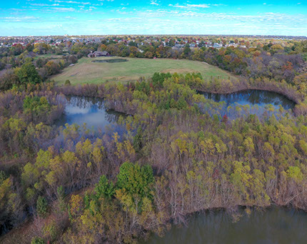
The U.S. Army Corps of Engineers (USACE) has the responsibility under Section 404 of the Clean Water Act and Section 10 of the Rivers and Harbors Act of 1899 to require permits for certain construction activities in “waters of the United States.” “Waters of the United States” includes rivers, lakes, streams, creeks, natural ponds, and wetlands adjacent to such waters (defined at 33 CFR 328). These “waters of the United States” collectively represent aquatic resources that provide an innumerable set of services for the general public. These services include, for example, water quality improvement, flood damage reduction, water-related recreation, storm flow conveyance and storage, maintenance of base flow, movement of commerce, spawning and nursery areas for aquatic organisms, and habitat for fish and wildlife.
Construction activities authorized by a Department of the Army permit may result in temporary and/or permanent adverse impacts to waters of the United States, including wetlands. The Regulatory Program regulations (33 CFR 320-331 and 40 CFR 230) authorize the Corps to require mitigation for project impacts. The Corps is committed to the protection of the aquatic ecosystem while administering a fair and equitable permit program. The Federal government has established a goal of "no overall net loss" of wetlands and the Corps has adopted this goal to the Regulatory Program. To "mitigate" means to alleviate or moderate something harsh, or to make or become less severe or intense.
Any proposed compensatory mitigation is based on the USACE guidelines. The goal of the proposed mitigation is to restore, create, and/or replicate similar wetland and waterway systems to replace, to the extent possible, the ecological characteristics of the formerly undisturbed aquatic resources. The mitigation plan will be site specific and based on what aquatic features would need to be restored or created at the site. The methods of compensation could include a combination of restoring formerly altered wetlands, enhancement of existing degraded wetlands, and/or creation of new wetland areas. Stream and riparian corridor mitigation can also be completed using restoration, relocation, or creation techniques.
EEC Mitigation and Monitoring Services Include:
- Compensatory Wetland, Waterway, & Pond Mitigation Plan Development & Coordination
- Wetland & Waterway Mitigation Designs using Restoration, Enhancement, & Creation techniques
- Riparian Zone/Corridor Mitigation
- Vegetative Species Selection, Regeneration, and Installation
- Site Progression Monitoring through conducting Baseline and Annual Monitoring Surveys as required by USACE permit authorizations
Once mitigation site development is complete, EEC performs baseline (as-built) surveys to document actual site development, provide an inventory of the trees/shrubs planted within the mitigation area, and photo-document the area(s) for future visual site progression comparison and reference.
Annual monitoring surveys generally begin in the growing season after the baseline survey is conducted. Mitigation area monitoring typically consists of 3 onsite surveys conducted during the growing season of each year during the USACE-specified monitoring period. Monitoring periods can vary from 5 to 10 years depending on the site complexity, however if the mitigation areas are documented as meeting the success criteria for 3 consecutive years, the USACE can release the permittee from further monitoring requirements. Each species planted (tree or shrub) is observed and characterized in terms of living or dead at the time of each field survey. Photographs are recorded to provide a visual representation of site and vegetation development.
The annual monitoring could include the following:
- Hydric soil development
- Wetland hydrology confirmation
- Tree survival rates
- Vegetation growth and condition
- Herbaceous species percent cover
Annual waterway & riparian zone monitoring would be conducted to identify:
- Waterway function
- Confirmation of stream flow using standard field indicators of hydrology
- Riparian corridor development progress
- Tree survival percentage
Offices in:
Vinita, OK 918 272 7656
Ft. Smith, AR 918 244 9595

Eagle Environmental Consulting, Inc. Vinita, OK (918) 272-7656 Ft. Smith, AR (918) 244-9595
All Material © Copyright 2018 by Eagle Environmental Consulting, Inc.
Website Design, Layout and UX by Babcock Illustration & Design